Cudgen Creek joins Cudgen Lake with the sea on the north coast of New South Wales. The entrance at Kingscliff has 2 training walls which keep the estuary permanently open to the sea. It is classed as a barrier river estuary.
The estuary meanders through Cudgen Nature Reserve parallel with the coast. The tidal waters of the lower estuary provide a popular swimming spot for locals and holiday makers.
Water quality report card
As part of our water quality monitoring program we assess the water quality and ecosystem health of an estuary using a range of relevant indicators. We sample 2 sites on a monthly basis over summer in Cudgen Creek every 3 years. The most recent sampling was completed over the 2018–19 summer.
This report card represents 2 water quality indicators that we routinely measure: the amount of algae present and water clarity. Low levels of these 2 indicators equate with good water quality.
Algae
Water clarity
Overall grade
The report card shows the condition of the estuary was excellent with:
- algae abundance graded excellent (A)
- water clarity graded excellent (A)
- overall estuary health graded excellent (A).
Grades for algae, water clarity and overall are represented as:
- A – excellent
- B – good
- C – fair
- D – poor
- E – very poor.
Go to estuary report cards to find out what each grade means, read our sampling, data analysis and reporting protocols, and find out how we calculate these grades.
| Year | Algae | Water clarity | Overall grade |
|---|---|---|---|
| 2012–13 | B | B | B |
| 2015–16 | B | B | B |
Physical characteristics
| Estuary type | Barrier river |
|---|---|
| Latitude | –28.26 (ºS) |
| Longitude | 153.58 (ºE) |
| Catchment area | 68.6 km2 |
| Estuary area | 2.1 km2 |
| Estuary volume | 2371 ML |
| Average depth | 1.1 m |
Tidal exchange volume
Tidal exchange volume or tidal prism data is available for this estuary. This tidal prism was measured in 1993.
| Tide state | Flow (ML) | Local tidal range (m) | Sydney Harbour tidal range (m) |
|---|---|---|---|
| Ebb flow | 800 | 1.24 | 1.46 |
| Flood flow | 790 | 1.25 | 1.52 |
Notes: km2 = square kilometres; m = metres; m3 = cubic metres; ML = megalitres.
Water depth and survey data
Bathymetric and coastal topography data for this estuary are available in our data portal.
Land use
Over two-thirds of the catchment of Cudgen Creek has been disturbed. Most land-use changes have been driven by agriculture, including sugarcane, cattle grazing and horticulture. Kingscliff and Casuarina are 2 major towns adjacent to the lower estuary.
National and marine parks
- The 2 conservation areas in the Cudgen Creek catchment are Mooball National Park and Cudgen Nature Reserve.
- This estuary does not flow into a marine park.
Community involvement
- Friends of Cudgen Nature Reserve is a volunteer bush regeneration group that works to restore degraded bush to health to support local native plants and animals.
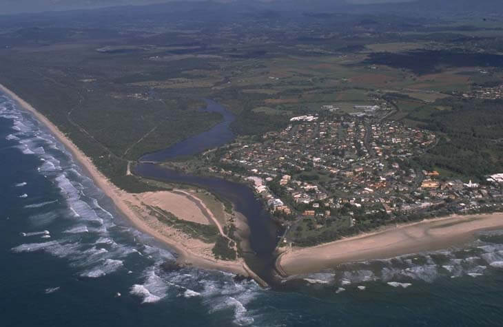
Aerial view of Cudgen Creek
Local government management
Local councils manage estuaries within their area unless the estuary is attached to a marine park. Tweed Shire Council manages this estuary.
Threatened species
Threatened species in the Cudgen Creek catchment area include plants such as lemon-scented grass, which grows in sandy soils near the creek. A significant koala population also lives in and around Cudgen Nature Reserve.
Read more about the biodiversity in our estuaries.