Werri Lagoon is located on the south coast of New South Wales near the township of Gerringong. It is classed as a creek with an entrance that is intermittently open and closed to the ocean
Werri Lagoon is typical of many intermittently closed/open lagoons on the south coast. The lagoon openings tend to last a few days to weeks as the entrance area is exposed to the ocean. The entrance of Werri Lagoon is managed by local government and is opened artificially when water levels threaten to inundate low-lying infrastructure.
Water quality report card
As part of our water quality monitoring program we assess the water quality and ecosystem health of an estuary using a range of relevant indicators. We sample a subset of the estuaries between Wollongong and the Victorian border every 3 years. The most recent sampling in Werri Lagoon was completed over the 2023–24 summer when 2 sites were sampled on a monthly basis.
This report card represents 2 water quality indicators that we routinely measure: the amount of algae present and water clarity. Low levels of these 2 indicators equate with good water quality. The numerical scores for these 2 indicators are averaged to give the overall grade.
Algae
Water clarity
Overall grade
The report card shows the condition of the estuary was poor with:
- algae abundance graded poor (D)
- water clarity graded poor (D)
- overall estuary health graded poor (D).
Grades for algae, water clarity and overall are represented as:
- A – excellent
- B – good
- C – fair
- D – poor
- E – very poor.
Go to estuary report cards to find out what each grade means, read our sampling, data analysis and reporting protocols, and find out how we calculate these grades.
We have monitored water quality in Werri Lagoon since 2011. This table shows the water quality grades for this estuary over that time.
| Year | Algae | Water clarity | Overall grade |
|---|---|---|---|
| 2023–24 | D | D | D |
| 2017–18 | C | C | C |
| 2011–12 | C | E | D |
Physical characteristics
| Estuary type | Creek |
|---|---|
| Latitude (ºS) | –34.73 |
| Longitude (ºE) | 150.84 |
| Catchment area (km2) | 16.5 |
| Estuary area (km2) | 0.1 |
| Estuary volume (ML) | 62.2 |
| Average depth (m) | 0.4 |
Notes: km2 = square kilometres; m = metres; ML = megalitres.
Water depth and survey data
Bathymetric and coastal topography data for this estuary are available in our data portal.
Land use
The catchment of Werri Lagoon is highly disturbed with 70% of land cleared for grazing and rural residence. Urban development associated with Gerringong and Werri Beach accounts for about 6% of land use, and about 20% of the catchment remains forested.
National and marine parks
There are no conservation areas within this catchment. This estuary does not flow into a marine park.
Community involvement
- Landcare Illawarra supports volunteer groups working to improve the environment in this region.
- South East Landcare is an umbrella organisation that represents related Landcare a networks, including Landcare Illawarra.
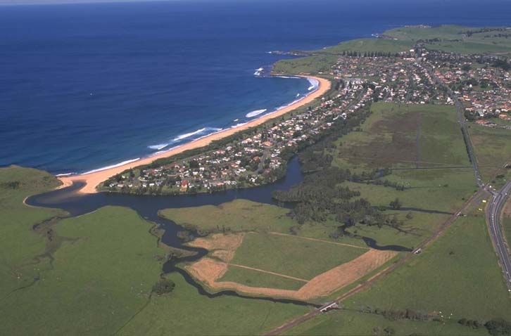
Aerial view showing Werri Creek running alongside the town of Gerringong and Werri Lagoon at the northern end of Werri beach.
Local government management
Local councils manage estuaries within their area. Where the estuary is attached to a marine park, marine park management is responsible for ensuring compliance with park zoning.
Werri Creek is managed by Kiama Municipal Council. Information about this estuary can be found on the council’s Coast and Estuary Management webpage.
This estuary provides an important protected environment for coastal saltmarsh, an endangered ecological community.
Read more about the biodiversity in our estuaries.