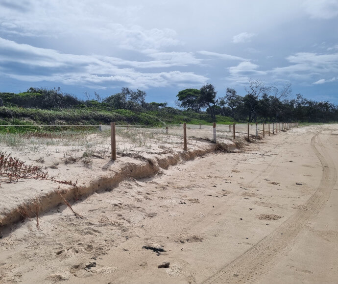
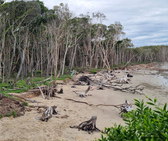
The campgrounds at Sandon River and Woody Head face coastal hazards including erosion, recession and inundation. These coastal hazards are threatening the use of the campgrounds and their natural and cultural values.
The National Parks and Wildlife Service (NPWS) has prepared coastal hazard response plans for Sandon River and Woody Head campgrounds, which include detailed coastal hazard studies and an assessment of potential management approaches. The NPWS coastal hazard response plans are supporting documents to the Clarence Valley Council Open Coast Coastal Management Program.
Consultation on the draft plans closed on 29 July 2024.
Sandon River
Sandon River campground is in Yuraygir National Park. The site is environmentally and culturally significant, forming part of the Solitary Islands Marine Park. The Sandon River campground is currently experiencing coastal erosion and inundation, which is impacting the access road and campground and is expected to worsen by 2043.
A coastal hazard response plan has been developed for Sandon River campground, which assesses the coastal hazards experienced at Sandon River and proposes options to manage the risks posed by coastal hazards.
We have prepared a factsheet that summarises the coastal hazards at Sandon River campground and how NPWS proposes to manage them.
Woody Head
Woody Head campground is in Bundjalung National Park. Woody Head beach is one of the fastest eroding beaches in New South Wales. Without protection access to the site is predicted to be compromised by 2030.
A coastal hazard response plan has been developed for Woody Head campground, which assesses the coastal hazards experienced at Woody Head and options proposed to manage the risks posed by coastal hazards.
We have prepared a factsheet that summarises the coastal hazards at Woody Head campground and how NPWS proposes to manage them.
What is a coastal hazard response plan?
A coastal hazard response plan is a technical document that identifies coastal hazards and the risk they pose to various assets. The coastal hazard response plan compares and assesses options to manage risks from the coastal hazards and recommends a preferred option.
The recommended options from the plans are actions in the Clarence Valley Open Coast Coastal Management Program.
What is a coastal management program?
Coastal management programs are the key tool of the NSW coastal management framework. Coastal management programs are led by councils and set the long-term strategy for the coordinated management of the coastal zone. Visit the NSW Government Coastal management programs webpage to learn more.
The NPWS coastal hazard response plans are supporting documents to the Clarence Valley Open Coast Coastal Management Program (CMP). The draft CMP is available on the Clarence Valley Council website.
Why have the coastal hazard response plans been prepared?
The Sandon River and Woody Head campgrounds are experiencing increased coastal erosion and inundation.
The Sandon River campground is currently impacted by riverine inundation, with the access road already inaccessible in periods of high tide. Coastal erosion is predicted to impact the campground before 2043.
Woody Head is one of the fastest eroding beaches in New South Wales, threatening NPWS assets and the campground. It contains significant cultural, natural and recreational values. Without intervention, the campground access road is predicted to be compromised before 2043.
The NPWS is taking proactive steps to manage coastal hazards at the campgrounds and has prepared coastal hazard response plans to assess and identify approaches to manage the risks posed by coastal hazards.

