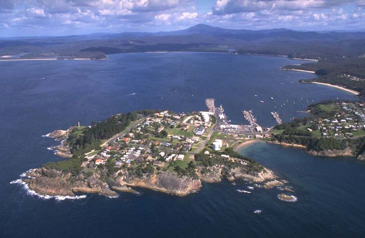
Twofold Bay is located on the far south coast of New South Wales about 400 kilometres south of Sydney and 40 kilometres north of the Victorian border. The bay is divided into 2 distinct bights, Calle Calle Bay and Nullica Bay, giving Twofold Bay its name.
The tributaries of Twofold Bay include Boydtown Creek, Lake Curalo, Nullica River, Shadrachs Creek and Towamba River, in addition to other smaller creeks and stormwater drainages.
Twofold Bay is known for its whaling history. Humpback whales often come into the bay in spring. Eden is the largest commercial fishing port in New South Wales and a principal export point for timber and timber products. Twofold Bay also contains a commercial mussel farm.
Water quality
Twofold Bay has not been sampled as part of our monitoring program. We monitor water quality in Curalo Lagoon, Fisheries Creek, Nullica River, and Towamba River the main tributaries to Twofold Bay.
Towamba River estuary was last sampled in 2008–09, Nullica River in 2011–12, Curalo Lagoon in 2017–18 and Fisheries Creek in 2020–21.
Go to estuary report cards to find out what each grade means, read our sampling, data analysis and reporting protocols, and find out how we calculate these grades.
Physical characteristics
| Estuary type | Bay |
|---|---|
| Latitude (ºS) | –37.08 |
| Longitude (ºE) | 149.95 |
| Catchment area (km2) | 11.0 |
| Estuary area (km2) | 30.7 |
| Estuary volume (ML) | 334,559.4 |
| Average depth (m) | 10.9 |
Notes: km2 = square kilometres; m = metres; ML = megalitres.
Water depth and survey data
Bathymetric and coastal topography data for this estuary are available in our data portal.
Seafood harvest area status
The NSW Food Authority website lists the current status of oyster/shellfish harvest areas.
Land use
The Twofold Bay catchment is largely undeveloped, with a significant amount of the catchment forested. The urban areas of Eden and Boydtown are concentrated on the north-eastern and south-western foreshores of the bay. The Beowa National Park fringes the southern and northern edge of the bay, and the commercially managed Nullica and East Boyd state forests are located to the north-west and south of the bay respectively.
National and marine parks
- Beowa National Park is the largest conservation area situated on the northern boundary of the Twofold Bay catchment.
- There is no marine park associated with this estuary.
Citizen science projects
- The Far South Coast Landcare Association is a volunteer environmental and conservation organisation that works to improve management of local land and water. This association manages the Eden Cove and Cocora Wetlands Group.

Aerial view of Twofold Bay estuary.
Local government management
Local councils manage estuaries within their area, unless the estuary is attached to a marine park. Bega Valley Shire Council manages this estuary.
Threatened species
Estuaries provide an important protected environment for salt-tolerant plants like sea grasses and mangroves.
Read more about the biodiversity in our estuaries.