Killick Creek is situated at Crescent Head on the mid-north coast of New South Wales. The estuary is classed as a lagoon.
The creek entrance is trained along its southern shoreline and is intermittently closed to the sea.
Killick Creek is also part of the Macleay River Flood Mitigation Scheme, with works done in the 1950s. Drains were created into the upper estuary and in places the estuary was artificially widened and deepened. The estuary is popular for recreational activities, especially swimming at the entrance.
Water quality report card
As part of our water quality monitoring program we assess the water quality and ecosystem health of an estuary using a range of relevant indicators. We sample a subset of the estuaries located between the Queensland border and Taree every 3 years. The most recent sampling in Killick Creek was completed over the 2015–16 summer when 2 sites were sampled on a monthly basis.
This report card represents 2 water quality indicators that we routinely measure: the amount of algae present and water clarity. Low levels of these 2 indicators equate with good water quality.
Algae
Water clarity
Overall grade
The report card shows the condition of the estuary was fair with:
- algae abundance graded fair (C)
- water clarity graded good (B)
- overall estuary health graded fair (C).
Grades for algae, water clarity and overall are represented as:
- A – excellent
- B – good
- C – fair
- D – poor
- E – very poor.
Go to estuary report cards to find out what each grade means, read our sampling, data analysis and reporting protocols, and find out how we calculate these grades.
We have monitored water quality in Killick Creek since 2009. This table shows the water quality grades for this estuary over that time.
| Year | Algae | Water clarity | Overall grade |
|---|---|---|---|
| 2009–10 | B | D | C |
Physical characteristics
| Estuary type | Lagoon |
|---|---|
| Latitude | –31.19 (ºS) |
| Longitude | 152.98 (ºE) |
| Catchment area | 7.9 km2 |
| Estuary area | 0.3 km2 |
| Estuary volume | 235.7 ML |
| Average depth | 0.8 m |
Notes: km2 = square kilometres; m = metres; ML = megalitres.
Water depth and survey data
Bathymetric and coastal topography data for this estuary are available in our data portal.
Land use
The catchment of Killick Creek is nestled along the coast between the much larger Macleay and Hastings river catchments. Most of the area remains vegetated, but some land-use changes have occurred for urban areas (12%) and associated areas of rural residence–grazing (20%). Crescent Head is the only township within the catchment.
National and marine parks
- Killick Creek’s estuarine delta is located within Hat Head National Park.
- This estuary does not flow into a marine park.
Community involvement
- Crescent Head and Point Plomer Bush Care is a volunteer-run bush regeneration program that facilitates regular working bees.
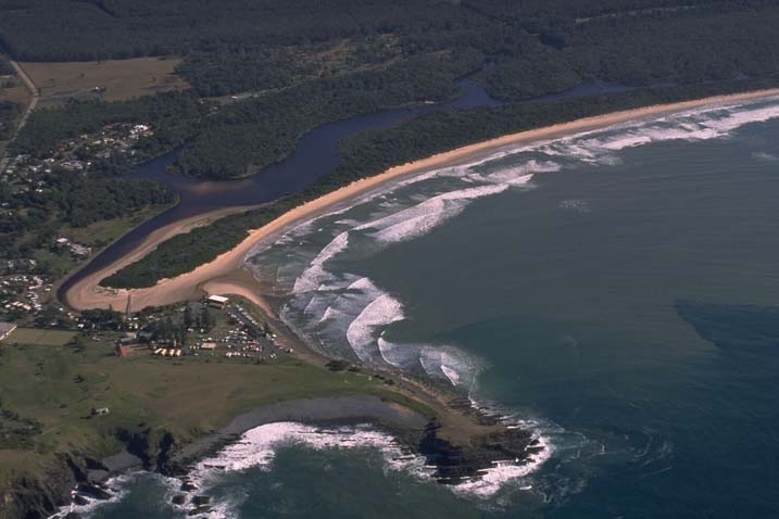
Aerial view of Killick Creek
Local government management
Local councils manage estuaries within their area unless the estuary is attached to a marine park.
Killick Creek is managed by Kempsey Shire Council. More information about this estuary can be found on the council’s Killick Creek estuary webpage.
Threatened species
Killick Creek estuary provides habitat for the critically endangered beach stone-curlew.
Read more about the biodiversity in our estuaries.