eSPADE is a Google Maps-based information system that allows free, easy access to a wealth of soil and land information from across New South Wales on both desktop and mobile devices. The data accessible through eSPADE is sourced mainly from the NSW Soil and Land Information System (SALIS) and includes the following.
Maps of major soil features across New South Wales, including:
- Over 73,000 observations of landscape and soil features, with more added every year
- Available as downloadable reports individually or in bulk
- Can be viewed as maps of profile points grouped using a number of different soil properties
More detailed information about the dataset can be found on the SEED (Sharing and Enabling Environmental Data) portal.
- Coverage of several key NSW catchments at mainly 1:100,000 scale
- Seamless maps of soil and landscape characteristics, qualities, limitations and hazards
- Detailed reports available for all map units.
More detailed information about the dataset can be found on the SEED (Sharing and Enabling Environmental Data) portal.
- Individual 1:100,000 or 1:250,000 topographic map sheets areas in Central and Eastern New South Wales
- Maps of soil and landscape characteristics, qualities, limitations and hazards
- Some map units have detailed reports
More detailed information about the dataset can be found on the SEED (Sharing and Enabling Environmental Data) portal.
- Broadscale mapping of landscapes and soils in the Western Division of NSW
- Reports on landforms, soils, erosion and vegetation
More detailed information about the dataset can be found on the SEED (Sharing and Enabling Environmental Data) portal.
- Acid sulfate soil risk throughout coastal New South Wales
- Detailed mapping at 1:25,000 scale
- Based on landform elements and extensive data collection
More detailed information about the dataset can be found on the SEED (Sharing and Enabling Environmental Data) portal and on the Coastal acid sulfate soils page.
- Integrates geology, landform, climate and vegetation for the identification of groundwater flows, salinity hazard and water quality
- Mapping in specific areas of the state at varying scales
More detailed information about the dataset can be found on the SEED (Sharing and Enabling Environmental Data) portal and on the Hydrogeological landscapes page.
- Maps showing a variety of key soil properties at various soil depths
- Generated by computer models based on relationships between various soil-forming factors, such as climate, geology, landform and land use
More detailed information about the dataset can be found on the SEED (Sharing and Enabling Environmental Data) portal and in the publication called Digital soil mapping of key soil properties over New South Wales.
- Describes the dominant land use over individual land parcels
- Mapped across most of New South Wales between 2002 and 2007
More detailed information about the dataset can be found on the SEED (Sharing and Enabling Environmental Data) portal.
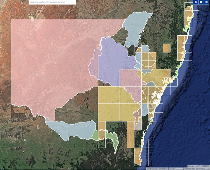
Index of soil mapping in New South Wales, available on eSPADE. 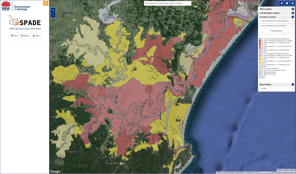
An eSPADE dataset is the Acid Soil Risk Mapping of coastal New South Wales. This map shows acid sulfate soil risk/probability in the Richmond Valley on the NSW far north coast. 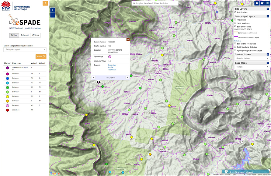
This screenshot of eSPADE shows several of the major datasets available: soil profiles (classified here by topsoil pH) and soil landscapes. 
A Brown Ferrosol near Glenrock in the Hunter catchment. The spatial extent of soils types can be viewed in eSPADE. 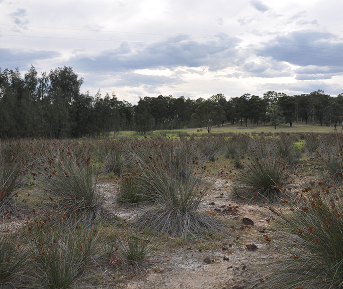
Dryland salinity north of Falbrook in the Hunter catchment. Sites with salinity can be indicated using the profile colour scheme dropdown in eSPADE. 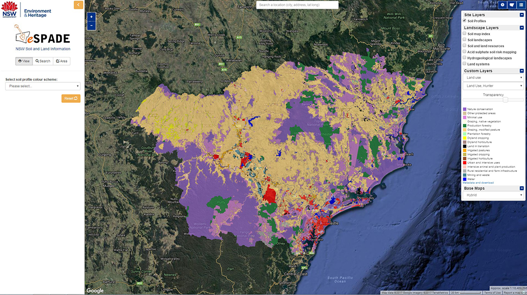
Landuse layer in eSPADE with the Hunter catchment selected and a satellite background chosen. Layer transparency can also be adjusted to enable spatial context. 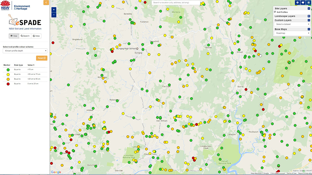
eSPADE giving profiles around the area of Dungog, coloured by their known profile depth. eSPADE provides detailed attribution information for thousands of NSW profile sites. 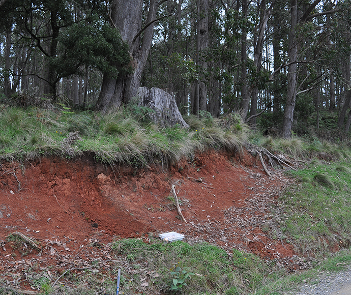
A Red Dermasol in the Nowendoc/Tuggolo Creek region in the Hunter catchment. The spatial extent of soils types can be viewed in eSPADE. 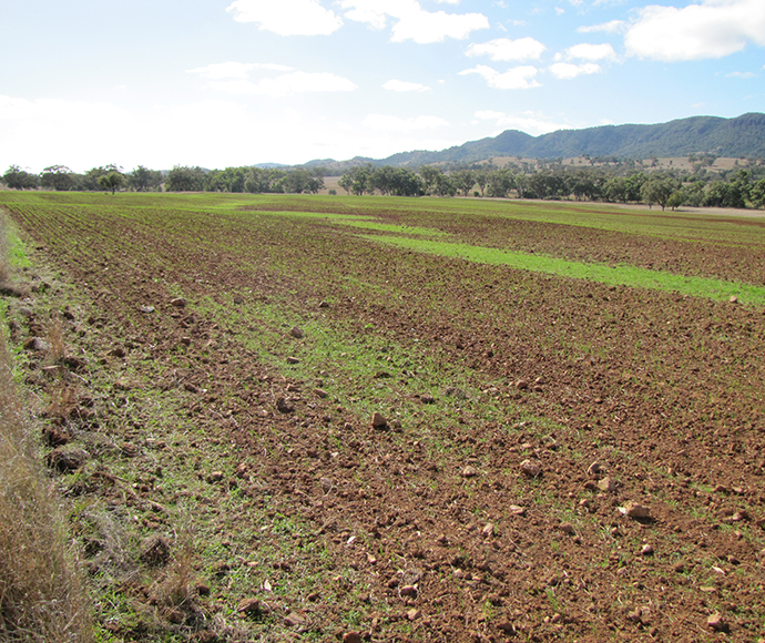
Red Chromosols in the Melville Range, south east of Carrol, New South Wales. 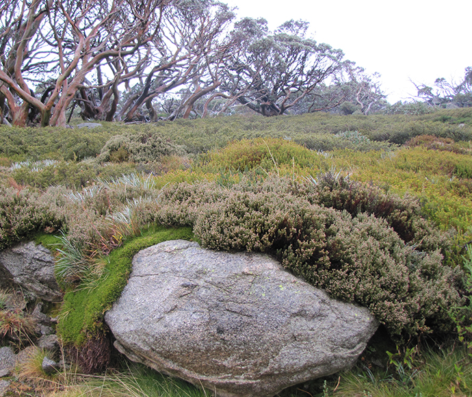
Soils support unique vegetation communities, as shown here at Charlotte Pass, New South Wales.
Can I contribute data to eSPADE?
Yes! For more information, see the SALIS page.
Download
Related resources
- Assessing the texture of your soil
- Glossary of terms used in soil and landscape science
- Soil Regolith Stability Classification for state forests in eastern New South Wales, Technical Report No. 41
- Detecting soil structure declineopens a new window
- Land and soil capability assessment schemeopens a new window
- SOILpak series onlineopens a new window
- Munsell soil color chartsopens a new window
- Soil chemical methods – Australasiaopens a new window
- Soils – their properties and managementopens a new window
- Soil physical measurement and interpretation for land evaluationopens a new window
- Guidelines for surveying soil and land resourcesopens a new window
- Australian soil classificationopens a new window
- Soils in the Australian landscapeopens a new window
- Australian soil and land survey field handbookopens a new window
- Interpreting soil test resultsopens a new window
SoilTalk! news
Stay up to date on the latest news and events about landscapes, soils and systems in New South Wales.