Belongil Creek is a lagoon with an intermittently closed entrance on the north coast of New South Wales. The entrance has a history of being artificially opened by council when high water levels threaten infrastructure, including the township of Byron Bay.
The upper estuary links with a large swamp system through a series of drains. A mix of agricultural, residential and industrial development impact on Belongil Creek.
Water quality report card
As part of our water quality monitoring program we assess the water quality and ecosystem health of an estuary using a range of relevant indicators. We sample a subset of the estuaries located between the Queensland border and Taree every 3 years. The most recent sampling in Belongil Creek was completed over the 2021–22 summer, when 2 sites were sampled on a monthly basis.
Algae
Water clarity
Overall grade
This report card represents 2 water quality indicators that we routinely measure: the amount of algae present and water clarity. Low levels of these 2 indicators equate with good water quality.
The report card shows the condition of the estuary was fair with:
- algae abundance graded excellent (A)
- water clarity graded poor (D)
- overall estuary health graded fair (C).
Grades for algae, water clarity and overall are represented as:
- A – excellent
- B – good
- C – fair
- D – poor
- E – very poor.
Go to estuary report cards to find out what each grade means, read our sampling, data analysis and reporting protocols, and find out how we calculate these grades.
We have monitored water quality in the Belongil Creek estuary since 2009. This table shows the water quality grades for this estuary over that time.
| Year | Algae | Water clarity | Overall grade |
|---|---|---|---|
| 2009–10 | C | C | C |
| 2012–13 | C | C | C |
| 2015–16 | B | E | D |
| 2018–19 | D | D | D |
Physical characteristics
| Estuary type | Creek |
|---|---|
| Latitude | –28.63 (ºS) |
| Longitude | 153.59 (ºE) |
| Catchment area | 30.4 km2 |
| Estuary area | 0.3 km2 |
| Estuary volume | 87.7 ML |
| Average depth | 0.5 m |
Notes: km2 = square kilometres; m = metres; ML = megalitres.
Water depth and survey data
Bathymetric and coastal topography data for this estuary are available in our data portal.
Land use
The catchment of Belongil Creek is highly disturbed. Cleared land for grazing, rural-residential development, and forestry are the main land uses. Urban development around Byron Bay as well as the town’s industrial estate has also led to significant changes. The hydrology in the upper catchment has been modified through a network of drains. Protected areas contain threatened species habitat, endangered ecological communities and important wildlife corridors.
National and marine parks
The largest conservation area in the Belongil Creek catchment is the Tyagarah Nature Reserve. Belongil Creek falls within the Cape Byron Marine Park.
Community involvement
Byron Bird Buddies is a volunteer community group involved with bird monitoring and conservation, as well as education about local bird species, in the Northern Rivers of New South Wales.
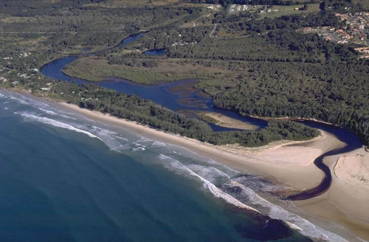
Aerial view of Belongil Creek estuary.
Local government management
Local councils manage estuaries within their area unless the estuary is attached to a marine park.
Byron Shire Council manages this estuary and has a dedicated Belongil Creek webpage, which contains the Belongil Creek Entrance Opening Strategy. The estuary is also managed as part of the Cape Byron Marine Park.
Threatened species
Belongil Creek estuary provides important habitat for threatened waterbirds and shorebirds, such as little terns and hooded plovers. A fenced shorebird conservation zone has been established near the entrance to protect their nesting areas.
Read more about the biodiversity in our estuaries.