Sydney Harbour is one of the world’s most iconic waterways. It has stunning natural features, internationally recognisable architecture and is the backdrop to Australia’s largest city. The harbour and its tributaries have significant cultural and heritage values, and offer opportunities for a variety of recreational activities. It also holds working value for transport, maritime, defence and the tourism industries.
Sydney Harbour extends 19 kilometres from the entrance, between North and South Heads, to the most westerly point where the Lane Cove and Parramatta rivers enter.
Water quality
Sydney Harbour has not been sampled as part of our monitoring program. We monitor water quality in the Parramatta River, Lane Cover River and Middle Harbour Creek, the major tributaries to Sydney Harbour. A long-term water quality monitoring program of the health of the harbour is being planned.
Physical characteristics
| Estuary type | Drowned valley |
|---|---|
| Latitude (ºS) | –33.83 |
| Longitude (ºE) | 151.29 |
| Catchment area (km2) | 55.7 |
| Estuary area (km2) | 29.1 |
| Estuary volume (ML) | 376,400 |
| Average depth (m) | 13 |
Notes: km2 = square kilometres; m = metres; m3 = cubic metres; ML = megalitres.
Land use
The Sydney Harbour catchment is heavily disturbed, with about three-quarters of the catchment area cleared for urban land use. Almost half of this urban area is residential and roads, with some commercial enterprise. Small areas of bushland remain intact and a number of parklands exist within the catchment.
National and marine parks
- Sydney Harbour National Park is the largest conservation area in this catchment.
- North (Sydney) Harbour Aquatic Reserve is located within the Sydney Harbour catchment and aims to conserve biodiversity and habitat.
- This estuary does not flow into a marine park.
Community involvement
- Greater Sydney Landcare Network is a community organisation and umbrella group for a host of Landcare organisations in the region. They have a number of projects listed on their website and support volunteers to get involved in work to protect, restore and improve the natural environment of Greater Sydney.
- The Sydney Institute of Marine Science offers a variety of public outreach programs to learn more about research in Sydney Harbour
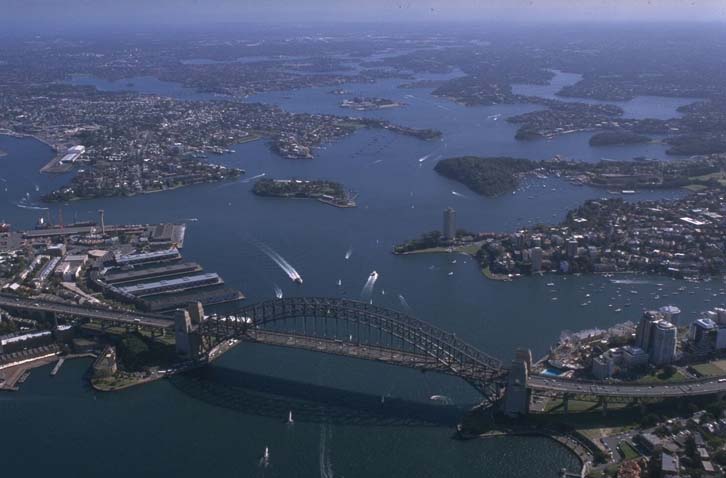
Aerial view of Sydney Harbour estuary.
Local government management
Local councils manage estuaries within their area, unless the estuary is attached to a marine park. The Sydney Harbour catchment spans multiple local government areas. The Sydney Coastal Councils Group promotes collaboration between relevant local councils on environmental management of the Harbour.
The Parramatta River Catchment Group is working with community, industry and government agencies to transform the Parramatta River into living waterways, with the mission of improving the quality of the river to make it a safe and enjoyable place to swim at a number of spots.
Threatened species
This estuary provides habitat for the endangered White’s seahorse, also known as the Sydney seahorse.
Read more about the biodiversity in our estuaries.