The Clyde River is classed as a barrier river with an open entrance situated in the Southern Rivers district.
The river flows over 100 kilometres through 3 national parks and 10 state forests out to Batemans Bay and is a significant focal point for the local community.
Water quality report card
As part of our water quality monitoring program we assess the water quality and ecosystem health of an estuary using a range of relevant indicators. We sample 2 sites on a monthly basis over summer each year in the Clyde River. The most recent sampling was completed over the 2023–24 summer.
This report card represents 2 water quality indicators that we routinely measure: the amount of algae present and water clarity. Low levels of these 2 indicators reflect good water quality. The numerical scores for these 2 indicators are averaged to give the overall grade.
Algae
Water clarity
Overall grade
This report card shows the condition of the estuary was good with:
- algae abundance graded good (B)
- water clarity graded excellent (A)
- overall estuary health graded good (B).
Grades for algae, water clarity and overall are represented as:
- A – excellent
- B – good
- C – fair
- D – poor
- E – very poor.
Go to estuary report cards to find out what each grade means, read our sampling, data analysis and reporting protocols, and find out how we calculate these grades.
Eurobodalla Shire Council have a long-term water quality monitoring program in the Clyde River, based on the same sampling and reporting methods as our statewide program. The results of the monitoring program, including a detailed water quality report card, are available on the Eurobodalla Shire Council website.
We have monitored water quality in the Clyde River estuary each year since 2007. This table shows water quality grades for the most recent 7 sampling seasons. Previous water quality data is available at NSW Estuary Water Quality Data Compilation: 2007–2020.
| Year | Algae | Water clarity | Overall grade |
|---|---|---|---|
| 2023–24 | B | A | B |
| 2022–23 | B | A | B |
| 2021–22 | B | B | B |
| 2020–21 | B | A | A |
| 2019–20 | B | A | B |
| 2018–19 | B | A | B |
| 2017–18 | A | A | A |
Physical characteristics
| Estuary type | Barrier river |
|---|---|
| Latitude | –35.71 (ºS) |
| Longitude | 150.18 (ºE) |
| Catchment area | 1722.9 km2 |
| Estuary area | 17.5 km2 |
| Estuary volume | 50736.6 ML |
| Average depth | 3 m |
Tidal exchange volume
Tidal exchange volume or tidal prism data is available for this estuary. This tidal prism was recorded in 1996.
| Tide state | Flow (ML) | Local tidal range (m) | Sydney Harbour tidal range (m) |
|---|---|---|---|
| Ebb flow | 18,440 | 1.28 | 1.42 |
| Flood flow | 20,360 | 1.44 | 1.58 |
Notes: km2 = square kilometres; m = metres; m3 = cubic metres; ML = megalitres.
Water depth and survey data
Bathymetric and coastal topography data for this estuary are available in our data portal.
Land use
The large catchment of Clyde River drains into Batemans Bay and remains relatively undisturbed. Up to 95% of the catchment is forest, with the upper reaches located in Morton National Park. Grazing and urban areas, which include Runnyford, Nelligen and Currowan, combine to form less than 5% of the catchment.
Water use
Find out about water use in the Clyde River, including information about major water users, real-time flow data, and environmental and water sharing plans.
National and marine parks
- The Clyde River flows through many conservation areas, including Morton National Park and Clyde River National Park.
- This estuary flows into Batemans Marine Park.
Citizen science projects
- The Budawang Coast Nature Map is an online data platform the community can use to record and identify biodiversity. Data collected is used to map the distribution of native plant and animal species from Moruya up almost to Kiama.
- iNaturalist’s Plants of Eurobodalla is a citizen science project that monitors plants found in the Eurobodalla region.
Community involvement
- The Clyde River supports regionally important oyster farms, which value good water quality in the area.
- The Clyde River and Jervis Bay Water quality objectives recognise environmental values and uses that local communities want protected.
- Eurobodalla Landcare is a volunteer network of 24 Landcare groups on the NSW south coast.
- The Coastwatchers Association is a community environmental and conservation group based on the south coast.
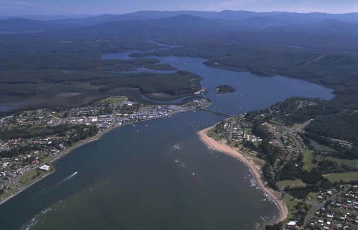
Aerial view of Clyde River
Seafood harvest area status
The NSW Food Authority website lists the current status of oyster/shellfish harvest areas.
Local government management
Local councils manage estuaries within their area. Where an estuary is attached to a marine park, marine park management teams are responsible for ensuring compliance with marine park zoning.
Clyde River estuary is within Batemans Marine Park.
Threatened species
Clyde River National Park has patches of rare forest red gum, Eucalyptus tereticornis. It also has endangered ecological communities such as river-flat eucalypt forest on coastal floodplains, and provides habitat for the threatened glossy-black cockatoo.
Find out more about biodiversity in our estuaries.